Product Name
Zeosnap
iOS App https://apps.apple.com/us/app/zeosnap/id6502942439
Android App https://play.google.com/store/apps/details?id=com.thinkstroke.zeosnap&hl=en
Webapp www.zeosnap.com
Project Description
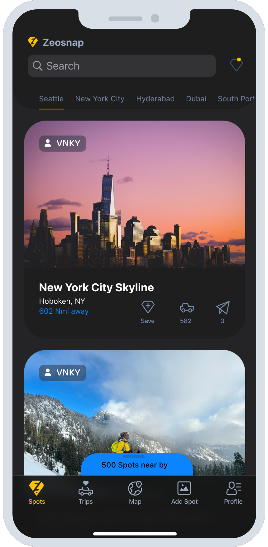
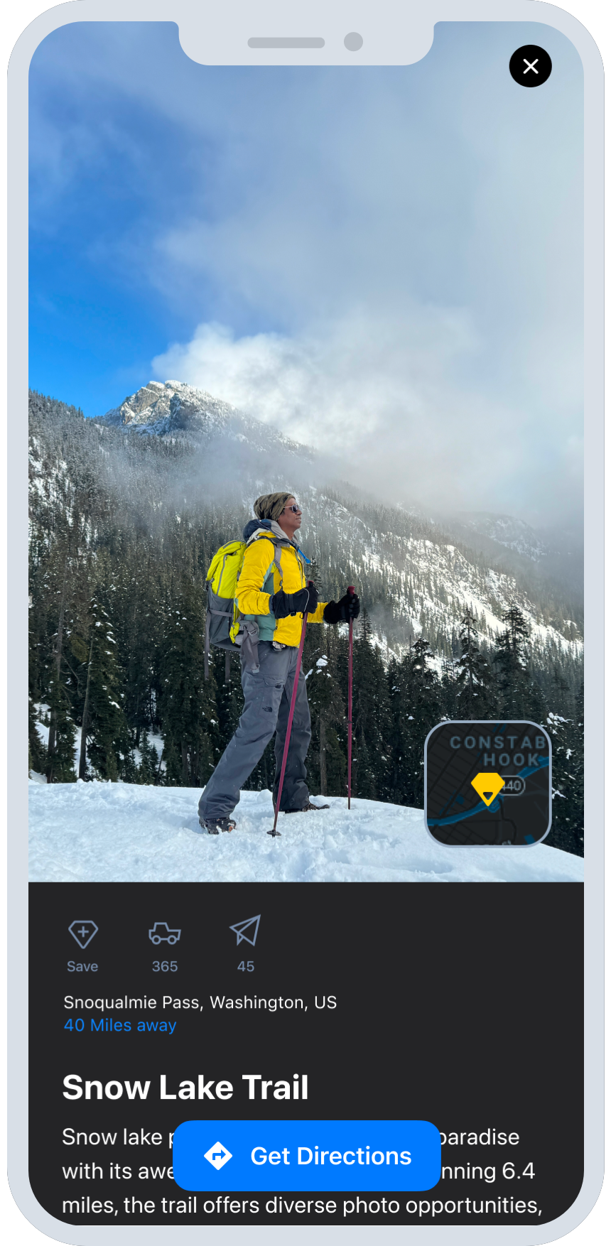
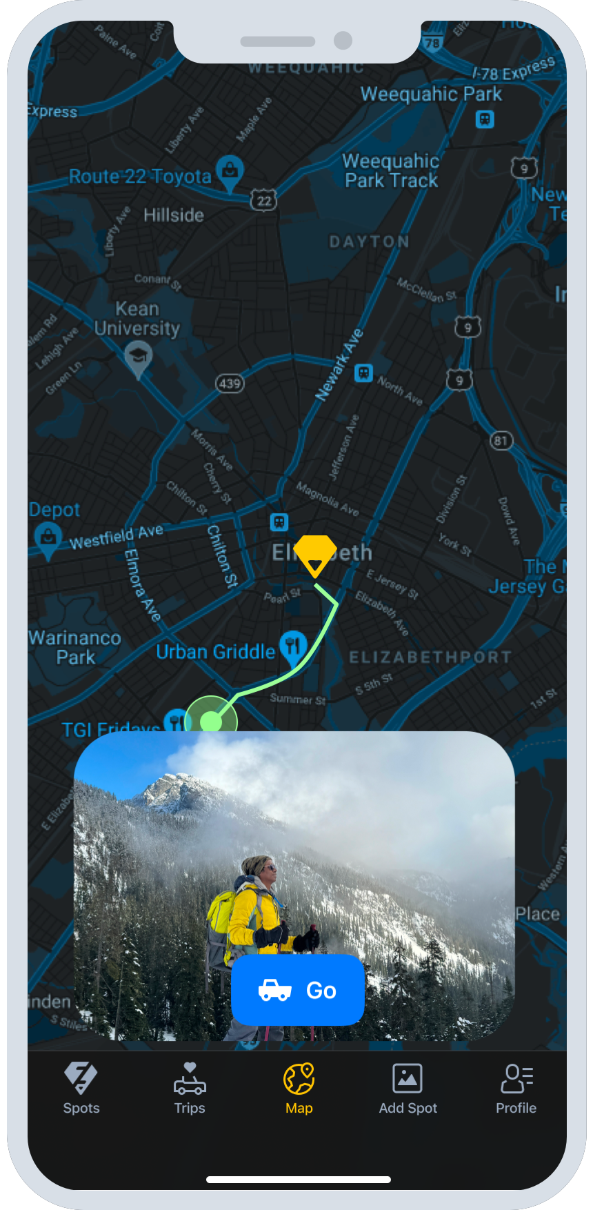
A passion project that discover and explore breathtaking photography locations with a user-friendly mobile and web app featuring a comprehensive navigation guide for seamless travel and unforgettable photo opportunities.
The Problem
For photographers, influencers, and travelers, it can be challenging to locate the exact scenic spots and vantage points to capture the most compelling images. Often, many visually stunning photographs shared online or in social media lack clear information about the specific location where they were taken. This makes it difficult for others to replicate or visit these picturesque sites, limiting the ability to discover new scenic destinations and plan effective photographic expeditions. Without access to precise location data, it can be time-consuming and frustrating for visual content creators and adventurers to find the most photogenic natural landscapes, landmarks, and points of interest to feature in their work.
My Approach
I started by conducting market research to understand any existing solutions available today. This involved exploring the landscape of geotagged image technologies and tools that could potentially extract location data from visual content.
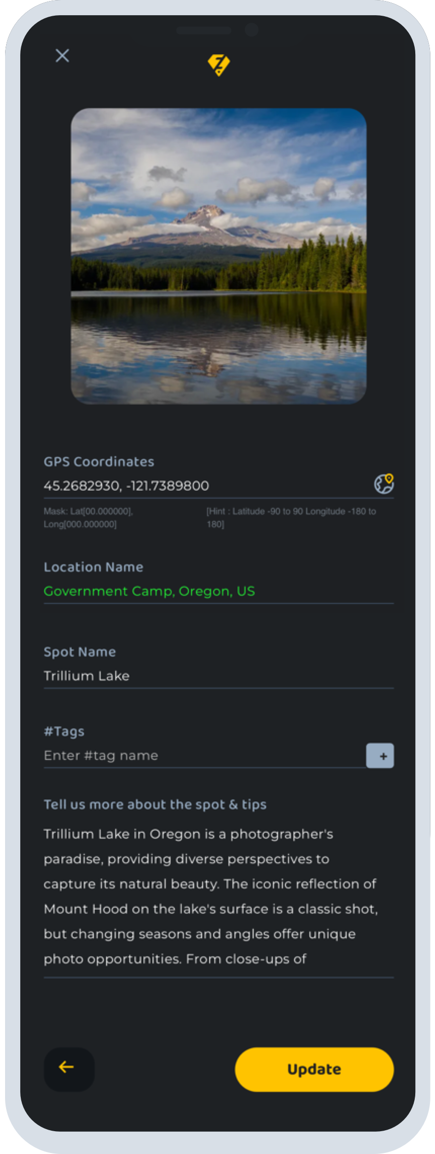
Through my market research, I discovered that many social media platforms, photo sharing apps, and camera devices already have the capability to geotag images with GPS coordinates when they are captured. This suggested that the core technology to embed location metadata within visual content already exists.
However, my further exploration revealed that while geotagged images are widely available, there is often a lack of clear, accessible, and comprehensive location information associated with many of the most visually striking photographs shared online. This highlighted an opportunity to develop a more robust solution to extract and surface the precise geographic coordinates from geotagged imagery.
To tackle this, I investigated different technological approaches that could be used to automatically parse location data from image files. This included researching computer vision and image processing techniques, as well as exploring APIs and tools that specialize in extracting geospatial metadata. By understanding the various technological capabilities in this space, I aimed to identify the most effective and scalable methods to integrate location discovery into a solution for my target users.
Through this initial market research and technology exploration phase, I was able to gain a deeper understanding of the problem space and the existing landscape of solutions. This informed my approach to designing a more comprehensive and user-friendly way for photographers, influencers, and travelers to access the exact locations of scenic points of interest.
Evolution of a Brand
The design process was guided by the essence of Zeosnap - geo-location, snapshots, and value. Featuring a fusion of location markers and the letter "Z," the logo symbolized innovation, connectivity, and user-centricity, amplifying ZeoSnap's brand identity.
Roles & Responsibilites
Build the concept, enhance branding, conduct thorough UX research, design a user-friendly app, and develop a seamless product
Tools
Sketch, Invision, Visual Studio Code, Flutter.